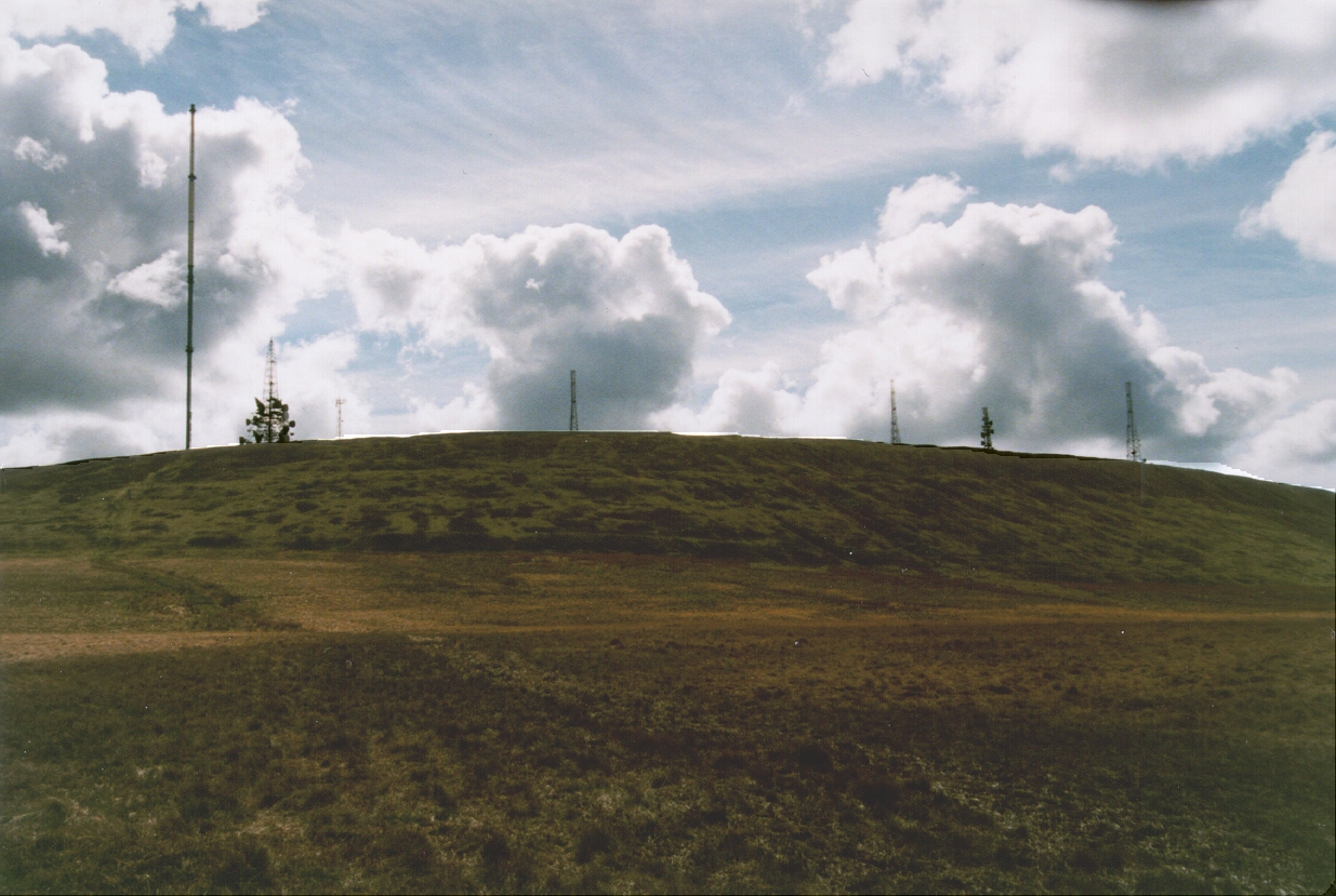
Winter Hill
| Wind Directions | NNW - NE | OS Ref | SD 660 150 (Sheet 109) |
|---|---|---|---|
| Height ASL | 1496ft (456m) | Rating | CP |
| Top to Bottom | 397ft (121m) | Notam | 8.072 |
Directions
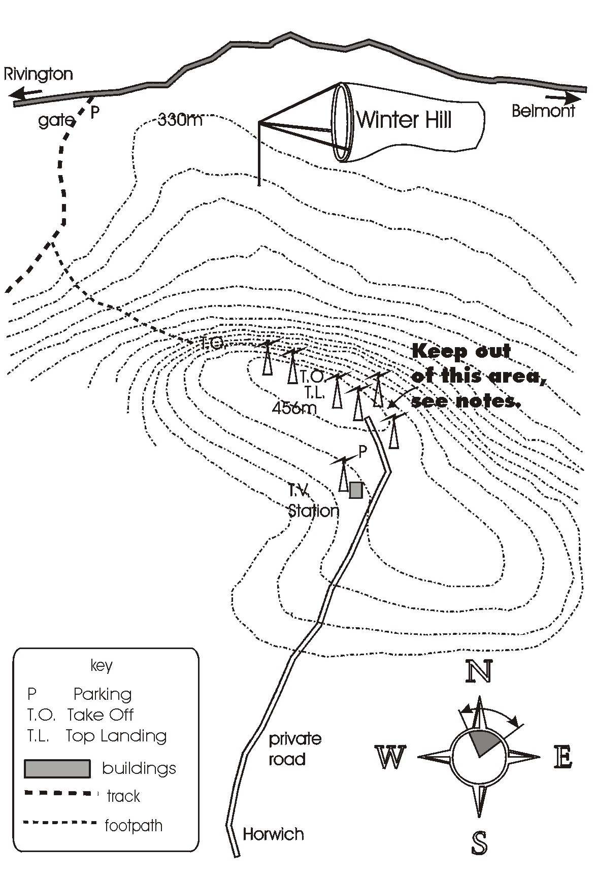
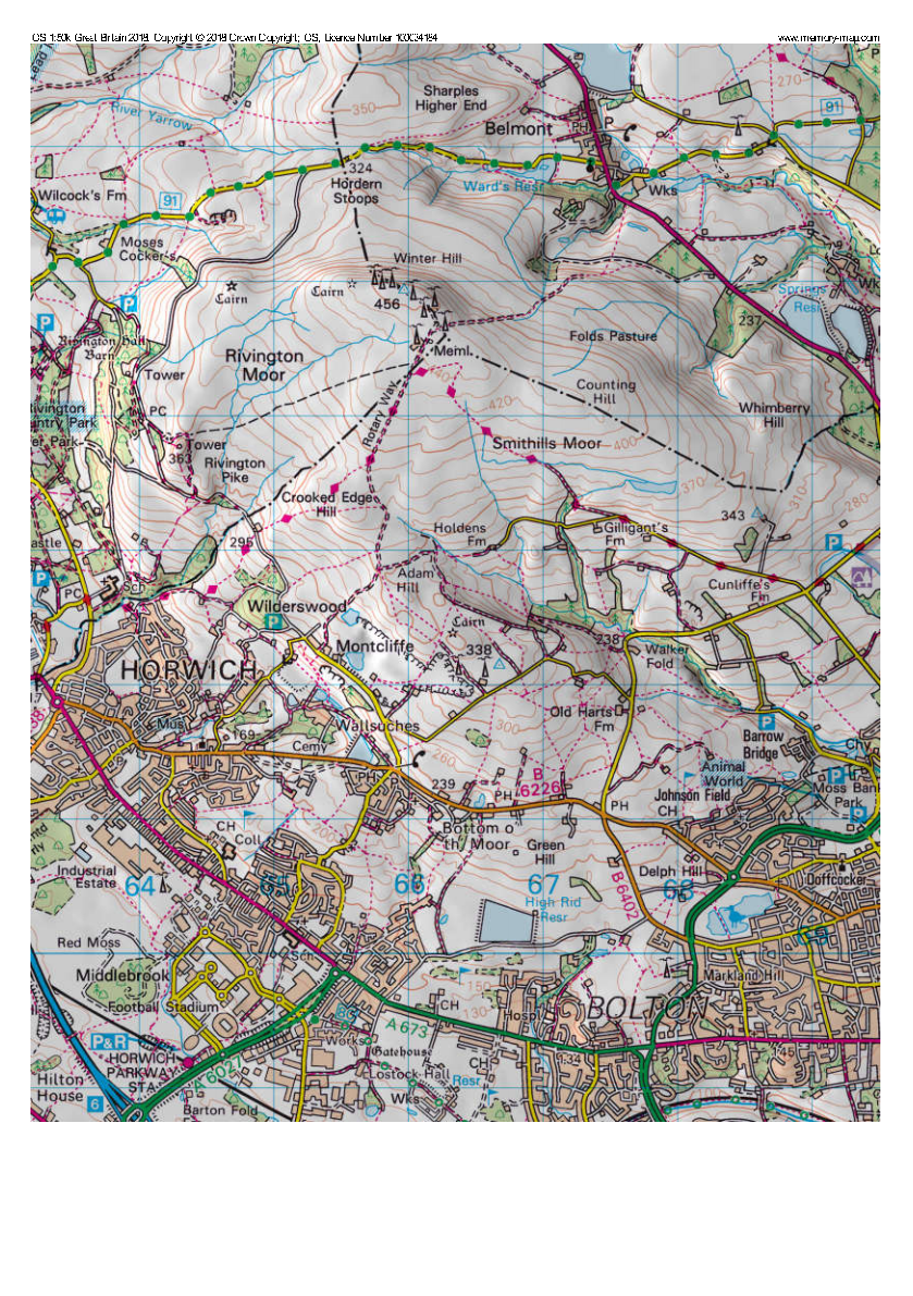
From the B6226 Horwich to Bolton road, where the road crests opposite the pub, turn into Georges Lane. Go past the quarries till the road narrows by some houses with stone walls. Turn right between the houses and follow the narrow road past the transmitter.
Access
Top driveable site! The Club has negotiated use of the access road to the transmitter, but be aware that the access gate is locked at 5PM each day. Parking is obvious; don’t block any gates to the smaller antennae. In times of increased fire risk, there may be restrictions on access.
Restrictions:
The access to Winter Hill is via a private road with a combination-locked gate. The general public have not been allowed to use the road since the terrible fires which devastated the moors in recent years. The PSC has negotiated access on behalf of members who are allowed to use this road in order to fly the site. The combination on the lock is changed periodically, and the Sites Officer is given the new code. Members wishing to fly Winter Hill can obtain the current code by contacting one of the Committee.
United Utilities are pleased with how this has worked so far, but have said that they are concerned about some misuse of the system and that access has been obtained by unauthorised persons. It is vital that any PSC member who obtains the code must follow the following procedure:
•never share the code with anyone who is not a PSC member
•do not leave the gate unlocked after passing through
•don’t allow a following car to tailgate you through, unless you are confident they are legitimate users
•always scramble the code on the lock after closing it
Thank you
PSC Committee
Airspace
Manchester TMA 3500ft alt, Class A, 2000ft (610m) ato.
Safety
Owned by United Utilities, access is via ITL land who run the transmitter compounds. Take care; there is a lot of debris in the field.
Notes
In general the site is less turbulent than Longridge. However, it suffers from strong wind compression for similar reasons to Edenfield, and also suffers (or benefits!) from wave effects. When there are signs of wave, it's best to watch carefully what the wind is doing, it can cycle quickly from light to very strong and back again.
The site also tends to be effected by sea breeze, and the wind often swings off to the North West towards the end of the day.
Restrictions
We share the site with the local aeromodellers club, please be courteous. There is an agreement to keep out of the Eastern end of the takeoff area, when aeromodellers are present. The boundary is 20 yards West of the fence that encloses the aerial at the East end of the ridge; please respect their right to fly.
Paragliders
It goes without saying that all pilots should be wary of the transmitters and supporting cables but in particular this comment applies to paraglider pilots in anything but light winds.
Be careful of getting blown back onto the barbed wire fence, which is not far back from the takeoff and landing areas.
XC Potential
Manchester Control Zone only 8 miles away.